Flash floods, thunderstorms and hail have given way to a peaceful Melbourne overnight, with Tuesday afternoon’s wild weather all but forgotten on Wednesday morning.
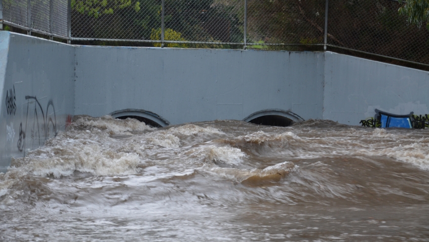
While Melbourne’s inner-north, east and south-eastern suburbs were pelted on Tuesday, causing flash flooding and evacuations of major shopping areas, the west was left largely untouched.
PICTURE GALLERY: Rowville flash floods
Got any pictures? Email us here
Bureau of Meteorology senior forecaster Terry Ryan said the storm formed over north-west Victoria but let loose over the east of Melbourne.
Overnight, Mount Hotham had the heaviest rainfall, with 68 millimetres, followed by Mount Buffalo, with 61 mm bucketing down.
In suburban Melbourne, Berwick was flooded with 28mm, and Essendon Airport received 26 mm of rainfall.
“In Melbourne, we had only 2.4 mm overnight, and Melbourne Airport had 13 mm of rain,” he said.
“In the west there was nothing.”
State Emergency Service crews were called to 959 jobs from 7pm Monday until midnight, a spokeswoman said, with the majority of calls coming from the metropolitan Melbourne region.
The SES spokeswoman said crews were flat out from late afternoon as thunderstorms battered central Victoria, with most call-outs involving cleaning up building damage, leaking roofs and unclogging drains.
After Melbourne, the most calls came from north-east Victoria, including Benalla and Wodonga.
“But we had only about 40 calls from there, compared to the hundreds we received from the Melbourne region,” the spokeswoman said.
The bureau cancelled its severe weather warning for thunderstorms at 12.28am on Wednesday, advising people to keep clear of fallen power lines, storm drains and flood water.
Likewise, wild winds completely subsided overnight, and all severe weather wind warnings have been cancelled.
Mr Ryan said Wednesday’s forecast high of 19 degrees would be accompanied by a possible morning shower in Melbourne, with a cold front on Thursday.

