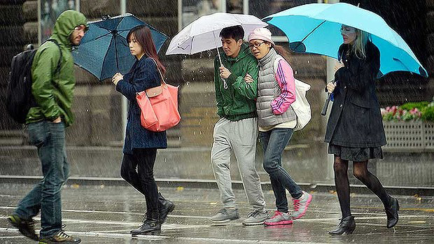
UPDATE: In a day of weather extremes, Melbourne has endured battering and damaging winds and is now facing an afternoon of dumping rain as a change moves through.
Thousands of Victorians are without power and the State Emergency Service has received over a thousand calls for help since midnight, as high winds brought down trees, closed roads and damaged homes.
High winds forced the popular Healesville Sanctuary to close its doors over concerns for visitor and animal safety.
Across the Bass Strait, a person was killed in Launceston, northern Tasmania, when they were hit by a falling tree about 12.30pm.
Details have not yet been released by Tasmania Police.
Bureau of Meteorology duty forecaster Gary Missen said gusts of over 100km/h had been recorded in the area surrounding Melbourne on Thursday.
“We’ve had a very mild day so far, with 19.9 degrees, which is expected to drop once the front arrives,” Mr Missen said.
SP AusNet spokeswoman Sarah Ward said about 20,000 customers had lost power, mostly in the east-Victorian towns of Moe and Traralgon and as close to Melbourne as Belgrave.
An additional 11,000 properties are without power west of Melbourne, Powercor spokesman Lyall Johnson said.
Mr Johnson said outages had affected Laverton, South Geelong, Colac and Apollo Bay.
Winds and falling trees had caused significant damage across Victoria by midday, forcing roads and train lines to be closed.
Metro said the Lilydale was suspended between Ringwood and Mooroolbark around 3.30pm after a tree fell across overhead wires and the rail tracks in the Ringwood East area. Replacement buses are in operation.
The State Emergency Services had received over a thousand requests for assistance since midnight.
“Most of those were in the metro area, and were mainly for trees down and minor building damage,” SES spokeswoman Kathryn Gould said.
Ms Gould said a large gumtree had fallen onto a house in Grand Ridge Road, in Mirboo North, in Gippsland.
A tree also fell onto two cars in the car park of a Coles supermarket in Bayswater, she said.
No one was injured in either incident, she said.
A number of roads, mostly in the state’s east, were closed or partly closed due to fallen trees.
Parts of a roof became airborne in Clayton, in Melbourne’s south-east, landing on a busy intersection about 11.30am.
A VicRoads spokeswoman said the debris had fallen near the intersection of Clayton and Carinish roads, causing heavy delays in the southbound lane.
Horse racing in Sale, Gippsland, has been abandoned due to the wind.
Buses were replacing trains between Upper Ferntree Gully and Belgrave on the Belgrave line after a tree fell across the track near Upwey about 11am.
A severe weather warning has been issued for most of the state, with damaging winds predicted to hit the Dandenongs, Macedon and Alpine ranges, Ballarat, the Grampians, Mornington, Bellarine, and the Surf and Bass coasts.
Low temperatures are expected to continue through the weekend, but winds are forecast to be light on Saturday and Sunday.
The State Emergency Service has warned Melburnians to secure loose outdoor items, to stay indoors and away from windows, not to park under trees, to be prepared for blackouts and to keep away from fallen trees and power lines.
Winds have forced the speed limit on the West Gate Bridge to be reduced to 60km/h.
Sydney is meanwhile forecast to bask in its warmest July day in almost a quarter of a century on Thursday.
If Sydney reaches the expected top of 25 degrees, it would be just the sixth such July maximum in the 155 years of record-keeping
The last time the city reached that temperature in July was in 1990.
Tasmania is also bracing for wild weather with flood warnings in place for the state’s north.
Heavy rain is expected on Thursday and a sandbagging effort is under way.
Residents in areas south of Hobart are facing blackouts through Thursday night.
El Nino-like conditions have persisted for much of this year, favouring warmer than average temperatures over southern and eastern Australia and drier conditions across much of the east.
But the bureau said on Tuesday that it had lowered its expectations that an El Nino would form this year to a 50/50 chance from previous estimates of a 70 per cent chance.
El Nino events typically see the Pacific Ocean become less of a heat sink, propelling global temperatures already elevated because of global warming closer to record levels.


