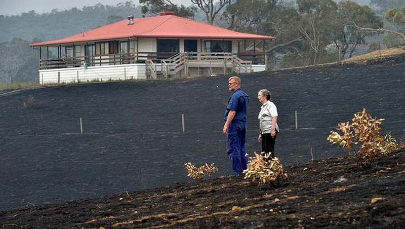
The Mickleham-Kilmore fire was a threat to the lives or safety of 13,000 people as it spread rapidly towards 5000 homes. The figures, based on CFA mapping, illustrate the gravity of the threat to Melbourne’s fast-growing outer fringe and nearby rural communities.
The 13,000 residents, some within a few kilometres of the fire area, could have been affected within minutes by sudden wind changes.
A map of the fire, published by Fairfax Media today, shows the unusual narrowness of the fire, which on Monday night was heading straight towards Kilmore. An edge heading towards a new housing estate was doused just metres away.
Deputy incident controller Tim Butcher, said the numbers illustrated the complexity of the fire and its vast impact.
”It really highlights the importance to communities and property owners to actually develop their bushfire survival plan. And to work out what they’re going to do in cases of fire,” he said.
”While we have a very modern, capable, volunteer response force in the CFA we cannot guarantee that individual houses will be safe, we cannot guarantee that we can protect all property.
”These fires can be spreading at 20 kilometres an hour.”
In other developments on Wednesday as Victoria’s bushfire crisis continued into its fourth day:
■ Rapid impact assessment teams made their way along Wallan Heights Road, an area where several houses are believed to have been destroyed.
■ Fears rose that agricultural losses such as dead livestock and destroyed fences could total tens of millions of dollars.
■ Roads to the fire’s west, in the Macedon Ranges Shire, were re-opened, allowing some residents to return to their burnt properties.
■ Police introduced a wristband system for Macedon Ranges allowing residents to pass roadblocks and check their properties.
■ New mapping showed the Mickleham-Kilmore fire had a 221-kilometre perimeter.
Agriculture Minister Peter Walsh said livestock losses from the Mickleham fire ”could be as high as 20,000”, and the fire would be a setback for many farmers. It is believed it affected about 500 farms. Mr Walsh feared some farms were severely affected, suffering big stock, pasture and fencing losses.
”It effectively means they’ll have no income for this year. And, depending on when it rains and when they can actually re-stock the property, they’re looking at negative incomes for two or three years probably,” he said.
The impact of the fast-moving fire on the rural community of Darraweit Guim was apparent early on Monday. Every couple of minutes shots rang out as charred livestock were destroyed. In some places the shootings started on Sunday night.
Police began issuing wristbands on Wednesday morning at the Romsey Community Hub to residents who could prove they lived inside the fire area.
Fire Services Commissioner Craig Lapsley said authorities were beginning to let residents back into Kilmore, Wallan and Craigieburn to survey the damage to their homes and properties. Wristbands were being handed out to allow them to pass roadblocks while preventing looting.
But authorities would not open roads while they still believed there was a risk vehicles would be struck by falling trees. ”We have had that occur to our fire trucks, so trees are a critical safety issue,” Mr Lapsley said.
But, despite the new access arrangements, hundreds of properties in the area remain empty because many homes are without electricity. At 5pm on Wednesday about 300 properties in Wallan, Kilmore and nearby rural communities were without power.
A spokesman for SPAusNet said 176 customers around Wallan were reconnected late on Tuesday.
”At around midday, roadblocks were starting to be removed, allowing our assessment teams to start ground patrols, clear vegetation and start replacing damaged assets. It’s too early to predict when electricity will be restored to all properties,” he said.
Eighteen Victorian fires were yet to be controlled. Although fire conditions have eased, four ”watch and act” messages remained in place on Wednesday afternoon in Victoria.
A clearer picture of the damage from fires in East Gippsland has emerged, with fire authorities confirming 14 of the 34 confirmed house losses in East Gippsland, in Cabanandra (6), Martins Creek (3), Goongerah (2), Walpa (1) and Glenaladale (2). But the total toll is certain to rise above 34, with unconfirmed reports of 20 more houses lost or damaged, some of them in the Wallan area.


